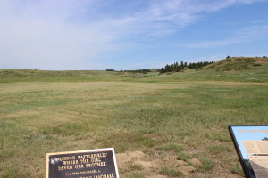
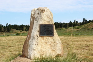
 Rosebud Battlefield State Park is located in southern Montana, about 45 minutes north of Sheridan, Wyoming, just off of State Highway 314. Like all the state parks in Montana, there is a small fee required to visit, unless you get the annual pass for Montana State Parks. Note that there is no visitors center here.
 This battlefield is where the Rosebud Battle (sometimes also referred to as Battle of Rosebud Creek, or Crook’s fight on the Rosebud, or from the Native American side, the Battle Where the Girl Saved Her Brother). It was significant from at least two points. Crook’s army was surprised at the ferocity with which the Native American’s fought. It had been thought that they would not have been so willing and able to fight. Although some say this battle was a draw, some say the army won, since they held the land at the end of the day, the fact still remains, that the effects of this battle caused Crook to take his troops back to the Sheridan, Wyoming area for rest and resupply. This made them unavailable to the battles that occurred north at Little Bighorn and likely affected the events there.
This was also one of the larger battles between the Native American’s and the Army–almost 2500 total, including 1500 Sioux and Northern Cheyenne, and 1000 troops, did battle on June 17, 1876. This park is remote, quiet, in a beautiful location, and fairly undeveloped. Yet, reading the interpretive displays and imagining what it would have been like the day of the battle is interesting.
Since this park is somewhat undeveloped, it may not seem as exciting. But it has been left in a state that is very similar to what it was during the days of the battle. Because of that, It’s used by the military for studying certain types of battles.
See more about this battle, battlefield, and park here, here, and here. There is also a Rosebud Battlefield blog specifically about this area, the battle, and the archaeology efforts that are ongoing there. There is also an extremely detailed description of the park and its features, along with a very detailed description of the events of the battle located in the submission to place this area on the National Register of Historic Places.
There is also a buffalo jump in the park that can be visited. There are petroglyphs on the rocks and other Native American features in that area. The information at the park is lacking about the buffalo jump, petroglyphs and other monuments in the area. I found all this out after we had visited the battlefield.
If you take the loop road, there are two roads or trails leading off to the north from that road. The eastern one will take you to the Kobold Buffalo Jump, which is located at the approximate latitude, longitude of 45.22836,-106.97937. The western one will take you to Crook’s Hill (approx 45.2343,-106.9992) where General Crook observed the battle.
We wish that we had all this information when we went to the battlefield. It would have made things much more interesting. We hope that what we have provided you will give you more insight when you go.
